Modern science predicts hurricanes, floods, volcanic eruptions and other natural disasters to help avoid casualties and reduce economic damage. And only earthquakes strike in a completely unpredictable way, killing people where they feel most protected - in their own homes.
On the evening of November 11, 1855, in the capital of Japan, Edo (present-day Tokyo), the horizon was covered with haze, a strange breeze and fog rose from the ground, called "chiki" in Japan, but the stars burned unusually brightly. And the old watchman told the prince that the same weather was in Echigo and Shinshu, when he miraculously survived two strong earthquakes. They laughed at him, but he cooked up a supply of rice, put out the fire everywhere and waited.
At night, the earth shook, houses fell, but thanks to the foresight of the watchman, there was no fire in his yard. Japanese geophysicist Professor Tsuneji Rikitake, the author of the model of the earth's magnetic field, who devoted a special study of the validity of folk signs predicting earthquakes, considers this story to be a legend. And yet the old watchman may have been right in his own way. It has been established that during seismic activation, a particularly large amount of radioactive radon gas can be released from the ground. The charged particles emitted by it ionize air molecules, creating centers of moisture condensation and contributing to the formation of fog.
Sometimes zones of active geological faults are traced from space or from an airplane along linear cloud accumulations. There have even been attempts to predict earthquakes using cloud maps, but without much success. The manifestations of earthquake precursors are very mosaic; therefore, it is natural for seismologists to strive to use characteristics that average their manifestation over a large area.
Such a characteristic can be the parameters of the ionosphere (especially of its lower layers, which are more exposed to the influence from the Earth's surface). The anomalous behavior of the ionosphere in the regions of strong earthquakes has been repeatedly recorded. A number of models have been proposed that connect the development of anomalies in the ionosphere with radon emissions, changes in the electric field strength in the atmosphere, and excitation of the ionosphere by low-frequency elastic vibrations that arise during the preparation of earthquakes.
It is shown that the average statistical characteristics of the ionosphere change during the preparation and implementation of earthquakes. However, these changes are small and are revealed only statistically for a large number of earthquakes, and for individual events they are imperceptible against the background of noise.

In fact, we do not know what an earthquake is. Back in the 1980s, the famous Soviet seismologist Nikolai Vissarionovich Shebalin insisted that predicting earthquakes is impossible, since there is no good physical model for them. This statement needs some clarification. It is generally accepted that the cause of earthquakes is high tectonic stresses, and they themselves are interpreted by analogy with the destruction of an ordinary rock sample, only a very large one. It is not difficult to take a sample, put it under a press and, gradually increasing the effort, finally destroy it. It is also possible (albeit indirectly and very roughly) to estimate the magnitude of stresses in the lithosphere.
So, it turns out that these stresses are much less than those required for the destruction of rocks. How, then, do earthquakes occur? It is not clear yet. The existence of the so-called deep earthquakes is especially mysterious. At enormous pressures inside the Earth's mantle (and earthquake foci are recorded down to a depth of 700 kilometers), even for a movement along an already prepared fault to occur, gigantic stresses are required. And there is no trace of the existence of such high voltages.
On the contrary, all the data indicate that the stresses in the mantle are very moderate. Perhaps, if there were no deep earthquakes, the textbooks would prove quite convincingly that there could not be any. It is difficult to interpret the set of possible predictive features without a satisfactory physical model.
It remains, in fact, to track the variations in the intensity of the seismic process and try to identify instabilities in its mode. It is on this approach that the currently existing forecast methods are oriented.
|
|||||||||||||||||||||
|
|
|
||
Signs, ritual customs are still preserved and modern civilized people treat them with a sense of respect and a secret hope that these pagan traditions, which have come down to us from time immemorial, carry a special understanding of life. They reflect protection from all possible troubles, they predict how your day will go - good or bad, and even what year you will have, what kind of groom (husband) you will meet and your boss will be supportive or irritable today.
If you ponder and analyze your behavior and actions over the past week, then no doubt, remember several dozen cases when you were reminded of the signs: you cannot return home, to the office, if you have forgotten something. If you returned, then you need to do certain actions (ritual) so that another trouble does not happen
Starting from childhood, you find yourself in life - in life, which, if you have not educated yourself enough, is woven of a wide variety of signs - harbingers of bad or good events. And attempts to ignore omens, to laugh at their superstition and at those who, with an incomprehensible, full of mystery feeling, follow, it would seem, the most incredible examples, ended completely unsuccessfully. And when you think about it, you always found that almost all significant events in your life were preceded by omens - special signs of fate.
Of course, from the point of view of modern science, the signs predicting any events in your life are nothing more than an accident. And the main argument is not repetition: the same omen can portend different events. And from the elementary laws of physics it is known that any physical law is fulfilled at any point in the universe. At the same time, there are many folk signs that are repeated with sufficient regularity.
Such signs - forerunners include the definition in winter - what the spring will be, and in the spring - what the summer will be, etc. On the other hand, there is an endless chaos of signs that are based on pure intuition of biological species. In one case, these signs need classification, in the other they do not. Precursors associated with changes in the weather are very accurately determined by biological species, since such a prediction since the appearance of biological species has been the most important for survival and further development. Currently, there is a super-sufficient amount of literature associated with precursors - relating to both folk and individual signs. Note that the accuracy of folk signs decreases with an increase in the urbanization of society (this is due to technoplasmic phenomena).
The second type will be associated directly with the prediction of the behavior of individual biological species. If the harbinger correctly predicts the expected event, then such a harbinger for a given biological species becomes a kind of mysterious sign that determines and directs further life.
Undoubtedly, using standard methods of analysis, any researcher will prove a random coincidence of signs-precursors that precede real events. Since for one biological species, the omen predict an event, but for the other not. And if you map the above provisions on the prediction of earthquakes, they will, to a certain extent, coincide with the predictions of certain biological species. Naturally, there are differences in the definition of signs-precursors: if biological species still determine signs on an intuitive level, then in seismology, precursors are determined by precise instrumental methods.
The powerlessness of biological species before natural disasters, especially manifests itself during destructive earthquakes. In the past few years, intense seismic activity has led to a number of strong earthquakes in various regions of the Earth. The earthquakes in Kobe and South Sakhalin, Turkey and Taiwan, as well as the recent Italian earthquake, almost came as a complete surprise, which caused enormous material damage and also resulted in human casualties. The prediction of such events from the day of the birth of science - seismology, included: from a sharp denial of a positive solution to the problem, to the unconditional "discovery" of the only method that uniquely solves the problem. The opposition of these two points of view, on the problem of predicting earthquakes, still feeds the constant interest of scientists in the study of both the physics of the source and the identification of precursors. The reasons influencing the occurrence of earthquakes are summarized in the following provisions:
1. Earthquakes occur in the case of a pronounced heterogeneity of the Earth's crust, which leads to a quasi-periodic distribution of stresses in a certain volume, ie, a gradual increase in stresses under the influence of internal and external factors. it is possible to predict, due to the long duration of the preparatory process.
2. Earthquakes occurring against the background of medium or even insignificant stresses are likely to arise only under the influence of external factors, in particular, under the influence of solar activity. Such events are difficult to predict, although, if we assume that the cause is a sharp change in direction, then such an earthquake should correspond to a sharp change in the direction of radiation from the sources of weaker events, and, consequently, an increase in the frequency composition relative to the average frequency fields of the study area.
3. Earthquakes, which are caused only by internal factors: high inhomogeneity of the environment and, as a result, high tension in the environment. In this case, external factors are very insignificant and do not affect the processes occurring in the crust and mantle. Such earthquakes probably include events occurring in the mantle, as well as microearthquakes М< 4.0. (магнитуда землетрясения).
The influence of global external factors and their interaction, both with global internal factors and with the characteristics of individual seismically active regions, have a complex relationship. In particular, in Japan, Kawasumi T. calculated the repetition period of strong earthquakes in 69 years for the Tokyo area. Such an earthquake happened with a rather small time error, but not in the Tokyo area, but in the Kobe area. Here there is an almost accurate prediction of the time of the event and an obvious error in space. It should be noted that if the cycle of spatial changes in the physical characteristics of the environment were studied and calculated, and the direction of such changes was determined, then, most likely, it would be possible to estimate the possible place of the expected event. The prediction made by T. Kawasumi refers to low-frequency wave fields, in which the main component of the quasi-harmonic component of the temporal energy field of a seismically active region is estimated.
The assessment of such components is associated with a long-term forecast. In the mid-term and short-term forecast, higher-frequency anomalies are distinguished from the general energy field of the studied area. At the present time, a large number of precursors have been discovered and are being investigated, which, with varying accuracy, portend catastrophic events. All precursors studied and studied by seismologists represent temporary fluctuations of geophysical wave fields and their interactions. In the third millennium, not precursors, in the traditional sense adopted by seismologists, will be intensively studied, but the mapping of anomalies of the third state of matter (solid) to the fourth - plasma (geoplasma anomalies), i.e., plasma parameters will be investigated, as harbingers of earthquakes.
The concepts of bioplasma and geoplasma, which are the main ones, are given in the works of V.M. Inyushin, who hypothesized the existence of the Earth's geoplasm, which affects the development of the biosphere. In this article, we will focus on what the second millennium has opened in the field of earthquake prediction and what methods exist in traditional seismology. method of registration of plant biofields Inushenu V.M. managed to predict several earthquakes. It is a generally accepted fact that, to one degree or another, various observation methods very clearly reveal anomalies before strong earthquakes. Unfortunately, most of the anomalies are identified after the registration of the earthquake, but it should be said with all certainty that there are anomalies and from them it is possible to estimate the time, place and magnitude of the expected event. The methods on the basis of which anomalies in the general energy field are distinguished, by many scientists, are subdivided as follows:
1. Geological
2. Geophysical
3. Hydrogeochemical
4. Biological
5. Mechanical
6. Seismological
7. Biophysical.
Geology, as a science, one of the first to describe the main cataclysms that have occurred since the formation of the Earth as a planet. All large faults surrounding the structural formations identified on the Earth's surface appeared as a result of catastrophic earthquakes. If we consider the North-Tien Shan region, then the faults of the sub-latitude, east-north-east and north-west rubbing are clearly distinguished. The study of faults and fractures in rocks is one of the factors that determines the possible location of a future earthquake. The emergence of foci in the areas of junction of large regional faults separating different structural formations is especially probable. Many geologists have repeatedly pointed to the seismic hazard of such zones in seismically active regions of the Earth. Although such an estimate is very conditional and refers to a long-term forecast, it is the main one for all subsequent studies of earthquake precursors.
Geophysical methods determination of precursors is based on the study of the physical state of the crust and mantle of seismically active regions. As a result, the density, electrical conductivity, magnetic susceptibility, velocities of longitudinal and transverse waves, etc. are estimated. Investigating the changes in these parameters in time and space, anomalous zones are identified, which can be sources of origin of earthquake foci. In this case, it is possible to estimate the volume of the environment in which there are physical prerequisites for the origin of an earthquake source. Recently, heat fluxes in the earth's crust have been very intensively studied, in connection with the identification of temperature anomalies, which include source areas. temperature field leads to a change in the chemical composition of water and gas carried to the surface, which is sometimes used as a very reliable precursor.
Hydrogeochemical methods based on the measurement of the content of chemical elements in ground and borehole waters. The content of radon, helium, fluorine, silicic acid and other elements, as the most characteristic precursors of upcoming earthquakes, is determined. Earlier, special attention was paid to the anomalous content of radon, which has a vivid example of a very pronounced anomaly before the Tashkent earthquake (1966, the duration of the anomaly was 6 months).
There is a belief that before an earthquake the catfish begins to show activity and bubbles form around its antennae, on the other hand, there are observations that many fish jump up in water bodies. Many observations refer to unusual behavior of domestic animals: cats, dogs, horses, donkeys, etc. Animals express unusual behavior a few hours before the main shock - in neighing, screaming, an urge to escape from an enclosed space, which quite often saved people's lives and is a natural harbinger of an impending catastrophe. There are many explanations for the above phenomena: from the consumption of water with an increased content of harmful substances, to the impact of high-frequency waves accompanying the process of deformation of rocks. Nevertheless, whatever processes cause abnormal behavior of animals, due to the short-term before the main shock), such precursors are, in some cases, the most reliable and refer to biological precursors.
Mechanical harbingers associated with the deformation of geological rocks, the movement of blocks and megablocks in seismically active regions.
T. Rikitaki and many other scientists note numerous facts of changes in distances, both in the plane and in the amplitude of the relief.
For example, before the earthquake in Corralitos (1964,), measurements were taken along a 25 km long profile crossing the San Andreas Fault. Within 15 minutes before the push, the profile length increased by 8 cm, and 10 minutes after the push by another 2 cm. In general, the average speed of movement along the break is 4.4 cm / year. At the Alia-Ata seismological polygon, geodetic measurements are carried out from year to year, which show a sharp difference in the speeds of movement of megablocks: Chilik - 13 mm / year, North Tyanshansky - 4 mm / year, and in the area of the Alma-Ata depression - 2-6 mm / year. (expansion, contraction) of rocks. Before the earthquake, an increase in the frequency of oscillations and the amplitude of deformation precursors is observed. Deformation of rocks entails a change in the mode of manifestation of natural sources of groundwater. For the first time, changes in the flow rate of sources before an earthquake were noticed in antiquity.
In Japan, such phenomena were noted before many earthquakes with M> 7.5. At present, Chinese scientists have carried out a detailed and meticulous analysis to measure the flow rate of water before strong earthquakes (M> 7.0). The research has shown clearly pronounced anomalies that can be used in the practice of forecasting. Let us note a few facts from observations of the water level in wells and boreholes. Before the Prazhevalsk earthquake (1970), a change in the level and temperature of the water was noted at 30 km from the epi-center, and before the Mekerin earthquake (1968) M> 6.8 at 110 km.
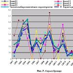
Identifying patterns in occurring earthquakes, as a set of events, is one of the most important tasks of seismology. The author dealt with the problem of the periodicity of the energetic manifestation of earthquakes, both for the entire Earth (M> 6.8) and for individual seismically hazardous regions: China and the Alma-Ata seismological test site (K> 10). As a result, data were obtained that, on average, confirm a pronounced cycle of activity of 20.8 years for the entire Earth and the Chinese seismically active region, and for the Alma-Ata seismological test site for the period from 1975 to 1987, cycles of 9.5 and 11 years were identified (K> ten). Such cycles of seismic energy release must be studied separately for each seismically active region in order to estimate the periods of activity. During these periods, observations of parameters that have predictive value are intensified. Such as the ratio of the velocities of the longitudinal and transverse waves, the ratio of the amplitudes of various types of waves, the change in travel times, the determination of the absorption and scattering coefficients, the calculation of the frequency of occurrence of microearthquakes, the identification of zones of temporary activity and calm.
According to the hypothesis put forward by Professor V.M. Inyushin - biophysical precursors reflect the anomalous manifestation of the Earth's geoplasm. Geoplasm affects the entire biosphere, which plays an important role in the development of biological species. As an example, let us give one of the measured components of geoplasma - atmospheric electricity:
Borok station is located near Moscow, thousands of kilometers from the epicenter of the Haitian earthquake, and nevertheless, the precursor was observed for 28 days. Geoplasma field Long before the earthquake, the earth was changed by a "powerful" geoplasma anomaly emanating from the epicenter of a future catastrophe. This geoplasma anomaly, to one degree or another, changed the bioplasma field of biological species.
To register abnormal manifestations of geoplasma, Professor V.M. Inyushin. developed a method, the essence of which is as follows: plant grains are isolated from external influences (Faraday grid), thereby forming a kind of bioenergetic structure that reacts to weak electromagnetic radiation. Under the influence of tectonic and deformation processes occurring in the crust and mantle, during the preparation of an earthquake, geoplasm anomalies appear, which are recorded by instruments (variations in electrostatic fields, and not just). Inyushin V.M. with employees, using the above method, it was possible to CREATE DEVICES for REGISTRATION OF EARTHQUAKE PREDICTORS and predict a number of earthquakes: 6-point, in the Dzhungar Alatau region (D = 34 km) and earthquakes in the regions of Kyrgyzstan, Tajikistan and China.
The study of "bioseismograms": the third millennium will focus on scientists. "Bioseismograms" define the "emotions" of biological species. Thus, fixing bioplasma fields by instrumental methods and determining the anomalies generated by geoplasma, earthquake forecast will be an ordinary reality, the same as weather forecast. It should be noted that humanity at an intuitive level, as described at the beginning of the article, identified signs as harbingers of future events. At present, the emergence of instrumental methods for measuring bioplasma confirms the ability of biological species to predict, since biological species are natural "sensors" of upcoming disasters.
Gribanov Yu.E.
Fri, 02/13/2015 - 22:24
Komarov S.M.
Harbingers of earthquakes
The seismic hazard map allows in principle to reduce damage from an earthquake. If building codes were always met and the long-term forecast was always correct, then the disaster would be without casualties. However, predictions are wrong, and when seismologists promise a strong earthquake within the next hundred years, the designer has a question - is it worth worrying about if the building has to stand for fifty years. In addition, construction norms may not be respected due to theft, as was the case in Spitak.
Even in earthquake-prone areas there are dilapidated buildings, people from which need to be evacuated in the first place, and hazardous industries that would be better stopped during a natural disaster. This can be done on the basis of short-term forecast data, when an upcoming seismic event is predicted in a few days. A mistake in such a forecast is very expensive: any evacuation affects the interests of a huge number of people and if the alarm is false, a completely predictable reaction will follow. But even worse, if a disaster happened, but no action was taken. The freshest example is the events of 2011 at the nuclear power plant in Fukushima: if the reactors were shut down in advance, the catastrophe would not have happened. Moreover, its consequences are not limited to radioactive contamination: the accident dealt a strong blow to the entire nuclear power industry.
Therefore, in the first half of the 20th century, a direction of geophysical research arose, associated with the search for earthquake precursors and the prediction of the location and strength of the tremors in a few days or at least hours. A lot of ideas about methods of searching for such precursors have been expressed, their number has long exceeded a hundred.
The easiest one is to observe the behavior of animals. Its basis is folk stories that cats, dogs, cattle, sometimes wild animals, birds, fish begin to behave in an unusual way on the eve of a strong earthquake. It is assumed that animals feel the harbingers of events inaccessible to humans, such as the increasing rumble of the Earth or the release of deep gases. But in order to give clear recommendations to the population, a large amount of statistics is needed, and this requires long-term systematic observations. Earthquakes, especially strong ones, happen infrequently and not on schedule. As a result, it has not yet been possible to make animal behavior a reliable indicator of seismic events.
Observation of the state of the electric field of the planet seems to be a more scientific method. The voltages accumulating in the blocks of the earth's crust are powerful enough to cause a change in the electrical properties of a substance. This is how electrical precursors of an earthquake appear - anomalies of electrical currents in the earth's crust or in the behavior of the geomagnetic field.
The rumble of the Earth due to the destruction of rocks during the activation of the hearth is another harbinger. For example, scientists from Kamchatka installed hydrophones in several lakes of the peninsula and found that in 70% of cases these devices hear a characteristic noise from an impending earthquake within a radius of 100-200 km several hours before the event. One of the first precursors, to which geophysicists drew attention back at the end of the 19th century, is the behavior of groundwater.
Sometimes effects are observed, the physical mechanism of which is not clear. Here's an interesting example. In 1983 L.N. Rykunov, Corresponding Member of the USSR Academy of Sciences, Professor of Moscow State University. M.V. Lomonosov, initiated long-term observations of high-frequency seismic noise in Kamchatka. Now two such stations are located in Kamchatka and one each on the islands of Shikotan and Hokkaido. Information collected over a quarter of a century has shown that shortly (from one week to two months) before an earthquake of more than six points, these fluctuations are synchronized with the main lunar diurnal tidal wave. The phase difference between the tidal component extracted from the noise and the wave turns out to be more or less constant all the days remaining before the earthquake, while it usually changes arbitrarily. And for less strong earthquakes, no connection was found. From 1992 to 2006, this precursor was observed for all 18 earthquakes with a magnitude of more than six points within a radius of 400 km from the station. Only one event with a magnitude of seven on March 8, 1999 broke the pattern. Scientists from the Kamchatka Branch of the Geophysical Service of the Russian Academy of Sciences managed to derive an empirical formula that relates the magnitude of an upcoming event and the distance to it from the place of observation. Perhaps in the future they will be able to more accurately predict the location of the future focus and the date of its activation using several stations.
In general, geophysicists assess the work on short-term forecasting as very far from completion and point out that all attempts to reliably link the precursors with future events ended in failure.
It is possible that such a sad situation is due to the imperfection of methods for measuring and processing data. Academician V.N. Strakhov in a speech dedicated to the 80th anniversary of the Institute of Physics of the Earth named after O. Yu. Schmidt in 2008, explicitly urged his colleagues not to fool the country's leadership with promises to forecast earthquakes. In his opinion, to solve this problem, it is necessary not only to increase the number of seismic stations hundreds of times, but also to learn how to solve systems of linear equations with hundreds of thousands of variables, which requires computers and software that do not yet exist.
Many geophysicists believe that a forecast cannot be given in principle, since the geophysical environment has excess energy and any weak impact can lead to its discharge in the form of an earthquake. Here is the opinion of one of them, Doctor of Physical and Mathematical Sciences M.G. Savina: “The inapplicability of the classical approach for describing the source of an impending earthquake and assessing its seismic potential follows from the fact of the unique individuality of its main parameters, such as coordinates, depth, probable focal mechanism and type of movement, magnitude, and degree of source maturity. Therefore, one and the same precursor for different foci is filled with different content, which in turn makes any, even the most sophisticated, interpretation picture insignificant. The outbreak becomes elusive: we chase it with a butterfly net, like a butterfly, and it swims away from us like a deep fish, on which we need to put a net. It is for this reason that the formula becomes inapplicable: a forecast is the construction of a stable whole on the basis of a multitude of unstable components. It is for this reason that the world seismology for more than a century of existence can boast of only two earthquakes predicted in full ”.
Other column materials
Modern marine geomorphologists, developing the concept of the shelf, have replenished the stock of geographical terms with one more detailing the previous ideas about the underwater "stony shelves" of the continents. Within the framework of the shelves, they distinguish a coastal zone - a section of the seabed, bounded on the land side by the line of the maximum, annually repeated splash of the surf stream, and on the side of the sea - by a depth corresponding to 1/3 of the length of the largest storm wave in a given place. It is to this depth that active waves in the open sea penetrate. If we take it as 60 m, then the area of the coastal zone of the World Ocean turns out to be equal to 15 million km 2, or 10% of the earth's land surface.
In recent years, some scientists have defined the coastal zone as the contact zone of the mechanical interaction of moving masses of water and bottom material with each other and with a fixed bottom. ..

According to "authoritative sources", the past 2012 was declared by the ancient Maya the year of the end of the world. Soon after the "extreme" New Year holidays, a friend of my son decided to get more information on this issue and found a chronological table on the Internet: a list of dates of the apocalypses ever predicted by someone. As it turned out, a rare year was missed in it. The voluptuous anticipation of one's own death is one of the most beloved entertainments of mankind. The reason for the catastrophe can be called the devouring of the Sun by the mythical wolf Fenrir or the mythical dog Garm, the transformation of the Sun into a supernova, the commission of the Last Sin, the collision of the Earth with an unknown planet, nuclear war, global warming, global glaciation, the simultaneous eruption of all volcanoes, the simultaneous zeroing of all computers, simultaneous combustion of all transformers, AIDS pandemic, swine, chicken or cat flu. Some of these bleak predictions have nothing to do with science, others are based in part on scientific evidence. There are also those who have a chance to turn out to be a reality, because, you can't go anywhere, our planet is really a speck of dust in the infinite Universe, a toy of huge cosmic forces.

... The fact is that on the coast of the state there is the world's largest community of birds (up to 30 million individuals), intensively producing the best of natural fertilizers, containing 9% nitrogen compounds and 13% phosphorus. The main suppliers of this wealth are three species of birds: the Peruvian cormorant, the gannet and the pelican. Over the centuries, they have produced "drifts" of fertilizers up to 50 m high. To achieve such productivity, birds have to eat 2.5 million tons of fish per year - 20 ... 25% of the world catch of anchovy fish. Fortunately, upwelling provides in this area the accumulation of countless stocks of the main bird food - Peruvian anchovy. During the years of La Niña, its quantity off the coast of Peru is so great that not only birds, but also people have enough food. Until recently, the catches of fishermen in this relatively small country reached 12.5 million tons per year - twice as much as all other countries in North and Central America. Unsurprisingly, Peru's fishing industry accounts for one third of the country's gross foreign trade income.

After the tragic events of December 26, 2004 in Southeast Asia, almost the entire population of our planet started talking about the tsunami. After the water wall, an information tsunami hit you and me.
It was enough to look at the headlines of newspapers and magazines, listen to the announcements of TV and radio programs, or turn to the Internet. For example, such. "The intrigues of a leap year." "Tsunami - Earth's revenge for the thriving debauchery in the countries of Southeast Asia." "What's the matter with the weather?" "What's happened? How unique is it? " "Hurricane and Flood in Europe". "Unprecedented thaw in Moscow". Let's add from the author - both in Kharkov and in Ukraine as a whole the same thaw in January 2005 “Earthquake in Donbass”. "The Orange Revolution and the Tsunami - Links in the Same Chain". "Unprecedented snowfalls in Africa, America ...". "Tsunamis are the work of Jews." Tsunami - "the result of secret nuclear tests of the United States, Israel and India."

General information about the tsunami. Most often, a tsunami occurs as a result of an underwater earthquake. For the strongest earthquakes, about 1% of the earthquake energy is converted into tsunami energy. Interestingly, the energy of a tsunami grows in proportion to the square of the wave heights.
The length of the tsunami front is approximately equal to the length of the earthquake source, and the wavelength - to the width of the source. The height in the source does not exceed the height of the uplift of the rocks, i.e. 10 -2 -10 m for an earthquake energy of about 10 14 -10 20 J. imperceptible. The tsunami height increases significantly when approaching the coast, i.e., in shallow water. Usually the height of the water hill does not exceed 60-70 m.

In 1868, the expedition of the Swedish polar explorer Niels Nordenskjöld aboard the ship "Sofia" raised dark stones from the bottom of the Kara Sea, which turned out to be ferromanganese concretions (nodules). Then the oceanographic expedition of Great Britain on the corvette "Challenger" (1872-1876) discovered similar nodules at the bottom of the Atlantic in the area of the Canary Islands. The attention of geologists was attracted by the fact that, in addition to iron and manganese, a certain amount of non-ferrous metals was noticeable in them. Subsequently, underwater photography showed that the bottom sometimes resembles a cobblestone pavement: it is completely covered with nodules 4-5 cm in size. The nodules protrude from the silt or form a layer up to half a meter thick in the upper part of the ground. The amount of ore reaches 200 kg / m 2.

... In the development of Gidroenergoproekt (under the leadership of MM Davydov), water intake from the Ob and its transfer to the republics of Central Asia were supposed to be in the area of the village. Belogorie. It was planned to build a 78 m high dam with a power plant with a capacity of 5.6 million kW. Formed by the dam, the reservoir with a surface area of more than 250 km² spread along the Irtysh and Tobol up to the watershed. Beyond the watershed, the transfer route ran along the southern slope of the Turgai Gate along the channels of modern and ancient rivers to the Aral Sea. From there it was supposed to get to the Caspian Sea along the Sarykamysh depression and Uzboy. The total length of the canal from Belogorie to the Caspian Sea was 4000 km, of which about 1800 km were natural water areas and reservoirs. It was planned to transfer water in three stages: at the first - 25 km³, at the second - 60 km³, at the third - 75-100 km³, increasing the volume of water intake from the Ob ...

Quiet and slow earthquakes are fraught with danger. They can generate tsunamis or violent tremors that shock the earth's crust.
A giant landslide caused by a quiet earthquake could trigger a tsunami hundreds of meters high.
In November 2000, the largest earthquake in the last ten years hit the island of Hawaii. With a magnitude of 5.7, about 2 thousand cubic meters. km of the southern slope of Kilauea volcano gave a lurch towards the ocean. Part of the progress has taken place in the place where hundreds of tourists stay every day.
How did such a momentous event go unnoticed? It turns out that shudder is not common to all earthquakes. What happened on Kilauea was first identified as a manifestation of a quiet earthquake - a powerful tectonic movement that became known to science only a few years ago. My colleagues at the Hawaiian Volcanic Observatory of the US Geological Survey who were observing volcanic activity discovered a tremor. Noticing that the southern slope of Kilauea moved 10 cm along the tectonic fault, I found that the mass movement continued for about 36 hours - for a typical earthquake, the speed of a turtle. Typically, opposite fault walls heave in seconds, generating seismic waves that cause hum and shock to the surface.

... So, kimberlites and lamproites allowed us to look into the upper mantle of the Earth, to a depth of 150-200 km. It turned out that even at such depths as on the surface, the composition of the Earth is inhomogeneous. Variations in the composition of the mantle are caused, on the one hand, by repeated melting of igneous rocks (depleted mantle), and, on the other hand, by its enrichment with deep fluids and crustal material (enriched mantle). These processes are quite complex and depend on many factors: the composition of the introduced fluids and sediments, the degree of melting of the mantle material, etc. As a rule, they are superimposed on one another, causing complex multistage transformations. And the intervals between these stages can be hundreds of millions of years ...

Despite the progress in the synthesis of artificial precious stones, including diamonds, the demand for natural stones is not falling. Crystals, born millions of years ago in the depths of the earth, become the pride of museums and private collections, they are used as banking assets ... And most importantly, as in ancient times, diamonds remain the most desirable and expensive jewelry for women. But modern "treasure hunters" hope not only for luck: they seek to penetrate the very mystery of the origin of crystalline carbon in order to get their hands on a reliable guiding thread in their difficult quest ...
Once my teacher Zbigniew Bartoszynski, professor of the Department of Mineralogy at Lvov University, said with a touch of irritation: "Soon they will find diamonds at home behind the stove." It was about opening in 1980.
Earthquake harbinger
one of the signs of an impending or probable earthquake, expressed in the form of foreshocks, deformations of the earth's surface, changes in the parameters of geophysical fields, the composition and regime of groundwater, the state and properties of matter in the zone of the source of a probable earthquake. Signs of a probable earthquake are detected by monitoring the state of the environment using space, air, land and sea means.
EdwART. Glossary of terms of the Ministry of Emergency Situations, 2010
See what "Earthquake Harbinger" is in other dictionaries:
Earthquake harbinger- Earthquake precursor: One of the signs of an impending or probable earthquake, expressed in the form of foreshocks, deformations of the earth's surface, changes in the parameters of geophysical fields, composition and regime of groundwater, state and properties ... ... Official terminology
earthquake harbinger- 3.2.13. earthquake precursor: One of the signs of an impending or probable earthquake, expressed in the form of foreshocks, deformations of the earth's surface, changes in the parameters of geophysical fields, composition and regime of groundwater, state and ... ...
Earthquake harbinger- one of the signs of an impending or probable earthquake, expressed in the form of foreshocks, deformations of the earth's surface, changes in the parameters of geophysical fields, the composition and regime of groundwater, the state and properties of matter in the focus zone ... ... Civil protection. Conceptual and terminological dictionary
GOST R 22.0.03-95: Safety in emergency situations. Natural emergencies. Terms and Definitions- Terminology GOST R 22.0.03 95: Safety in emergency situations. Natural emergencies. Terms and definitions original document: 3.4.3. vortex: Atmospheric formation with a rotational movement of air around a vertical or ... ... Dictionary-reference book of terms of normative and technical documentation
This term has other meanings, see Radon (disambiguation). 86 Astatine ← Radon → Francium ... Wikipedia
State in Vost. Asia. In the first half of the 1st millennium AD. NS. known as the country of Yamato. The name is from the ethnonym Yamato, which referred to the union of tribes living in the center, part of Fr. Honshu, and meant mountain people, highlanders. In the VII century. the name is adopted for the country ... ... Geographical encyclopedia
- ... Wikipedia
Traditional religions Key concepts God · Mother goddess ... Wikipedia
Shigabutdin Mardzhani Shigabutdin Mardzhani (Shigabutdin bin Bagautdin al Kazani al Mardjani, Tat. Shihabetdin Mәrcani, Şihabetdin Mərcani; ... Wikipedia
T. ZIMINA
Earthquake in the city of Kobe (Japan). 1995 year. Building in the downtown area.
Earthquake in the city of Kobe (Japan). 1995 year. Crack in the ground at the ship pier.
Earthquake in San Francisco (USA). 1906 year.
Every year, several hundred thousand earthquakes occur on the globe, and about a hundred of them are destructive, bringing death to people and entire cities. Among the worst earthquakes of the outgoing twentieth century - the earthquake in China in 1920, which killed more than 200 thousand people, and in Japan in 1923, during which more than 100 thousand people died. Scientific and technical progress proved to be powerless in the face of the formidable elements. And more than fifty years later, hundreds of thousands of people continue to die during earthquakes: in 1976, during the Tien Shan earthquake, 250 thousand people died. Then there were terrible earthquakes in Italy, Japan, Iran, the USA (in California) and here in the territory of the former USSR: in 1989 in Spitak and in 1995 in Neftegorsk. More recently, in 1999, the elements overtook and buried about 100 thousand people under the rubble of their own homes during three terrible earthquakes in Turkey.
Although Russia is not the most earthquake-prone place on Earth, earthquakes in our country can bring a lot of troubles: over the past quarter of a century, 27 significant earthquakes have occurred in Russia, that is, with a force of more than seven on the Richter scale, earthquakes. The situation is partly saved by the low population density of many seismically hazardous regions - Sakhalin, the Kuril Islands, Kamchatka, Altai Territory, Yakutia, the Baikal region, which, however, cannot be said about the Caucasus. Nevertheless, in the zones of possible devastating earthquakes in Russia, a total of 20 million people live.
There is evidence that in the past centuries in the North Caucasus there were destructive earthquakes with an intensity of seven to eight points. The region of the Kuban Lowland and the lower reaches of the Kuban River is especially seismically active, where in the period from 1799 to 1954 there were eight strong earthquakes of magnitude six to seven. The Sochi zone in the Krasnodar Territory is also active, since it is located at the intersection of two tectonic faults.
The last fifteen years have turned out to be seismically turbulent for our planet. The territory of Russia was no exception: the main seismically hazardous zones - the Far Eastern, Caucasian, Baikal - became more active.
Most of the sources of strong shocks are located in the vicinity of the largest geological structure that crosses the Caucasus region from north to south, in the Transcaucasian transverse uplift. This uplift divides the basins of rivers flowing westward into the Black Sea and eastward into the Caspian Sea. Strong earthquakes in this area - Chaldyran in 1976, Paravan in 1986, Spitak in 1988, Racha-Dzhavsky in 1991, Barisakh in 1992 - gradually spread from south to north, from the Lesser Caucasus to the Bolshoi and finally reached the southern borders of the Russian Federation.
The northern end of the Transcaucasian transverse uplift is located on the territory of Russia - Stavropol and Krasnodar territories, that is, in the area of Mineralnye Vody and on the Stavropol arch. Weak earthquakes with a magnitude of two or three in the Mineralnye Vody area are common. Stronger earthquakes occur here on average once every five years. In the early 90s, fairly strong earthquakes with an intensity of three to four points were recorded in the western part of the Krasnodar Territory - in the Lazarevsky region and in the Black Sea depression. And in November 1991, an earthquake of a similar strength was felt in the city of Tuapse.
Most often, earthquakes occur in areas of rapidly changing relief: in the area of the transition of the island arc to the oceanological trench or in the mountains. However, there are also many earthquakes on the plain. For example, on the seismically calm Russian platform, about a thousand weak earthquakes were recorded over the entire observation period, most of which occurred in oil production areas in Tataria.
Is earthquake forecast possible? Scientists have been looking for the answer to this question for many years. Thousands of stations, densely enveloping the Earth, are watching the breath of our planet, and whole armies of seismologists and geophysicists, armed with instruments and theories, are trying to predict these terrible natural disasters.
The bowels of the earth are never calm. The processes taking place in them cause movements of the earth's crust. Under their influence, the surface of the planet is deformed: it rises and falls, stretches and contracts, giant cracks form on it. A dense network of cracks (faults) covers the entire Earth, breaking it into large and small areas - blocks. Along the faults, individual blocks can be displaced relative to each other. So, the earth's crust is a heterogeneous material. Deformations in it accumulate gradually, leading to the local development of cracks.
To predict an earthquake to be possible, you need to know how it occurs. The basis of modern concepts of the origin of an earthquake source are the provisions of fracture mechanics. According to the approach of the founder of this science, Griffiths, at some point the crack loses its stability and begins to avalanche
spread. In an inhomogeneous material, before the formation of a large crack, various phenomena that precede this process must appear - precursors. At this stage, an increase for some reason in the stresses in the region of the rupture and its length does not lead to a violation of the stability of the system. The intensity of the precursors decreases over time. Instability stage - an avalanche-like propagation of a crack occurs after a decrease or even complete disappearance of precursors.
If we apply the provisions of fracture mechanics to the process of occurrence of earthquakes, then we can say that an earthquake is an avalanche propagation of a crack in an inhomogeneous material - the earth's crust. Therefore, as in the case of material, this process is preceded by its precursors, and immediately before a strong earthquake, they should completely or almost completely disappear. It is this feature that is most often used when predicting an earthquake.
The forecast of earthquakes is also facilitated by the fact that the avalanche-like formation of cracks occurs exclusively on seismogenic faults, where they have repeatedly occurred earlier. So observations and measurements for the purpose of forecasting are carried out in certain zones according to the developed seismic zoning maps. Such maps contain information about earthquake sources, their intensity, recurrence periods, etc.
Earthquake prediction is usually done in three stages. First, possible seismically hazardous zones are identified for the next 10-15 years, then a medium-term forecast is made - for 1-5 years, and if the probability of an earthquake in a given place is high, then a short-term forecast is carried out.
The long-term forecast is designed to identify seismically hazardous areas for the coming decades. It is based on the study of the long-term cyclicity of the seismotectonic process, identification of periods of activation, analysis of seismic calm, migration processes, etc. Today, on the map of the globe, all areas and zones are outlined where, in principle, earthquakes can occur, which means that it is known where it is impossible to build, for example, nuclear power plants and where it is necessary to build earthquake-resistant houses.
The mid-term forecast is based on identifying earthquake precursors. In the scientific literature, more than a hundred types of medium-term precursors have been recorded, of which about 20 are mentioned most often. As noted above, anomalous phenomena appear before earthquakes: constant weak earthquakes disappear; deformation of the earth's crust, electrical and magnetic properties of rocks change; the level of groundwater falls, their temperature decreases, and also their chemical and gas composition changes, etc. The difficulty of medium-term forecasting is that these anomalies can manifest themselves not only in the focus zone, and therefore none of the known medium-term precursors can be attributed to universal ...
But it is important for a person to know when and where exactly he is in danger, that is, an event needs to be predicted in a few days. It is these short-term forecasts that are still the main difficulty for seismologists.
The main sign of an impending earthquake is the disappearance or reduction of medium-term precursors. There are also short-term precursors - changes occurring as a result of the already begun, but still latent development of a large crack. The nature of many types of precursors has not yet been studied, so you just have to analyze the current seismic situation. The analysis includes measuring the spectral composition of oscillations, the typical or abnormal nature of the first arrivals of shear and longitudinal waves, identifying a tendency to clustering (this is called a swarm of earthquakes), assessing the likelihood of activation of certain tectonically active structures, etc. Sometimes, preliminary shocks act as natural indicators of an earthquake - foreshocks. All of this data can help predict the time and place of a future earthquake.
According to UNESCO, this strategy has already predicted seven earthquakes in Japan, the United States and China. The most impressive forecast was made in the winter of 1975 in the city of Haicheng in northeastern China. The area was observed for several years, an increase in the number of weak earthquakes made it possible to declare a general alarm on February 4 at 14:00. And at 1936 hours an earthquake of more than seven points occurred, the city was destroyed, but there were practically no victims. This success greatly encouraged scientists, but a number of disappointments followed: the predicted strong earthquakes did not occur. And reproaches fell on seismologists: the announcement of a seismic alarm presupposes the shutdown of many industrial enterprises, including continuous operation, power outages, gas supply interruptions, and evacuation of the population. It is obvious that an incorrect forecast in this case results in serious economic losses.
In Russia, until recently, earthquake forecasting did not find its practical implementation. The first step in organizing seismic monitoring in our country was the creation at the end of 1996 of the Federal Center for Earthquake Prediction of the Geophysical Service of the Russian Academy of Sciences (FTP RAS). Now the Federal Forecasting Center is included in the global network of similar centers, and its data are used by seismologists around the world. It collects information from seismic stations or integrated observation points located throughout the country in earthquake-prone areas. This information is processed, analyzed and, on its basis, a current earthquake forecast is drawn up, which is weekly transmitted to the Ministry of Emergency Situations, and it, in turn, makes decisions on the appropriate measures.
The RAS Urgent Reporting Service uses reports from 44 seismic stations in Russia and the CIS. The forecasts received were accurate enough. Last year, scientists predicted in advance and correctly the December earthquake in Kamchatka with a force of up to eight points within a radius of 150-200 km.
Nevertheless, scientists are forced to admit that the main task of seismology has not yet been solved. We can only talk about trends in the development of the seismic situation, but rare accurate forecasts give hope that in the near future people will learn to adequately meet one of the most formidable manifestations of the power of nature.
Photo by O. Belokoneva.